"Mohican," "Lenape," "Delaware." These names bring the Leatherstocking Tales to mind. Those tales are set (mostly) in New York, but that would not have been too far from where we were. James Fenimore Cooper was a novelist, not a historian, so the tales are not accurate depictions of the times. Nevertheless, it was easy to get a glimpse of a romanticized primeval nature on some of our hikes.
The sign at the Outdoor Center states: The Mohican Outdoor Center represents a long history of recreation along the Kittatinny Ridge. From its beginning as a Boy Scout camp in 1927, people continue to explore the mountains, forests, and scenic views found here. Today, as part of Delaware Water Gap National Recreation Area, the center serves as a welcomed respite for Appalachian Trail hikers and a retreat for all to enjoy the natural world.
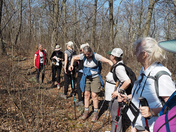
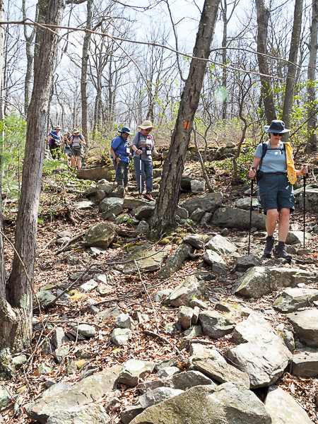
Our hike started with a steep climb up the Coppermine Trail to the AT running along the ridge. We spread out and the vanguard had time for a good rest while the more deliberate hikers caught up. I always prefer to be close to the front for that very reason -- there are more and longer rest stops.
Most of our hike leaders spend the winter season as ski instructors. We had fun conversations about skiing. Years ago Jim and I did a good bit of skiing in the Poconos, so there was some nostalgia.
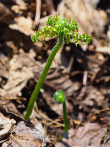
Plant life was burgeoning. It was very wintry looking when we arrived and by the time we left the hills were significantly greener. This fern is rapidly expanding past the fiddlehead stage.
The Delaware Water Gap National Recreation Area came about largely by accident. In the 1950s the U.S. Corps of Engineers proposed a dam just upstream from the water gap. The (oh-so-typical) rationale was for flood control, water supply, power generation, and recreation. By 1975 the government had condemned multiple properties, eliminated local communities, and forced about 600 families off land where they had lived for centuries. Salvage excavations during this time verified Lenape traditions that they had occupied the land since "time immemorial."
In the end, the local geology was deemed inappropriate for the dam and the entire project was canned. All of the acquired land was turned over to the National Park Service for administration. Of the stated goals of the dam, recreation was the one that remained -- more satisfying recreation than buzzing around a reservoir on a jet ski!
Similar displacement and ensuing bitterness occurred during the construction of Shenandoah National Park and the Blue Ridge Parkway in Virginia. As noted in the link, a local university has a program to preserve information about the displacement.
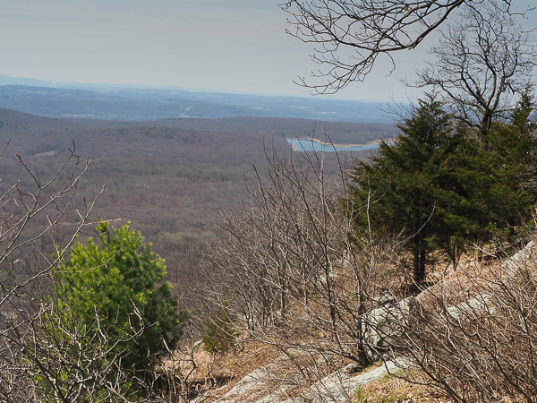
Looking south from the ridge, we can see a reservoir in the distance.
One of the hikers had acrophobia and on the first day quizzed the leaders about whether or not we would be hiking near any cliffs. On the first day we didn't. Today we did -- oh my! She made it past this cliff OK as did the rest of us. It even bothered me.
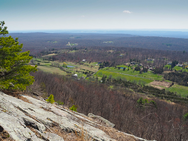
On a clear day you could see New York City -- if those far ridges weren't in the way. We are only about 90 miles from the Big Apple.
As I carefully inched across the rock face our young guide reassured me that if I slipped, she would catch me. I assured her that if I slipped, she should save herself and not worry about me. The drop-off was about 300 feet. I loved those hiking poles here!
What goes up must come down. I was very pleased with my new knee on these steep rocks. I could not have done it before -- except backwards or on my butt.
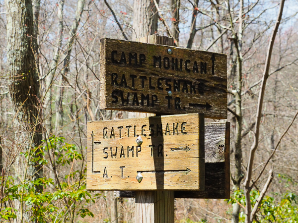
We descended on Rattlesnake Swamp Trail. The only snakes I saw during the week were a garter snake and a tangle of black racers, but some of our hikers did come upon a basking timber rattlesnake. Neither hikers nor snake suffered from the encounter.
Trail signs were rare. Mostly we navigated by the blazes describing the various trails. The AT is marked by white blazes -- usually on trees, sometimes on rocks. Part of our instruction was identifying trail markings: beginning of trail, end of trail & turn left or right at trail crossings. One of the hikers found a t-shirt with the white AT trail blaze and no further commentary.
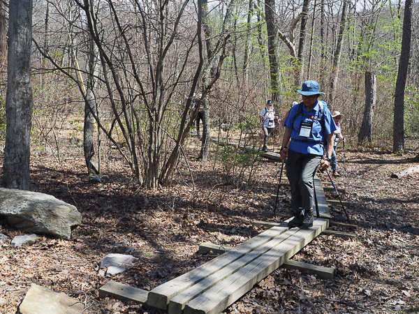
At the bottom of our descent, we followed these raised walkways. They protect the swampy land and give a firm place to walk. I would have been happier if they had been one board wider. The narrow width made using the poles awkward, but then again, I'm not responsible for building and maintaining the walkway.
Today's "short" hike was over four miles in a morning. It was just right for me.
After the hike we ate our bag lunches at the Camp Mohican Outdoor Center where we found the luxuries of picnic tables, port-a-potties, and shade. Most days we sat on rocks or fallen trees to eat and found minimally private "facilitrees" for needed relief. We were admonished to avoid the plentiful invasive Japanese barberry, which seemed to offer privacy because they were havens for ticks!
Click your "back" button to return to the previous page or click for our picture album.