An overview from AllTrails: "Highlights include beautiful views, well-maintained paths, and fun rock scrambles. Challenges are steep inclines, rocky terrain, and potential crowds." We didn't see the crowds, although we did meet some other hikers, but I can vouch for the inclines, rocks, and views. According to Hiking Guy, the name comes from an alternate spelling of “Munsee,” one of the bands of the Lenni Lenape people who lived in this region.
With excellent Road Scholar planning, this hike was our introduction to the AT with the opportunity to find our own hiking comfort zone. For each hike except the nature walk on the third day, we chose our own pace: "Masters" (long & fast), "Associates" (shorter and slower), and "Bachelors" (in-between). Notice that none of these classifications include "easy" in the description. In fact, AllTrails rates these hikes "hard." All of the groups encountered difficult and arduous terrain. On this first day we each elected to join one of the groups at the start, but after the first 1.5 miles, we had the opportunity to move up, move down, or stay in the same group. That first segment included a steep and rocky climb with the promise of more to come for the two longer groups. Hikers made their own choices and everyone seemed to make the right choice. I started with the middle group and elected to continue with it. It was at the limit of my stamina (no, I didn't do all of the recommended preparation). On subsequent days I elected the "Associates" group and was happy with my choice.
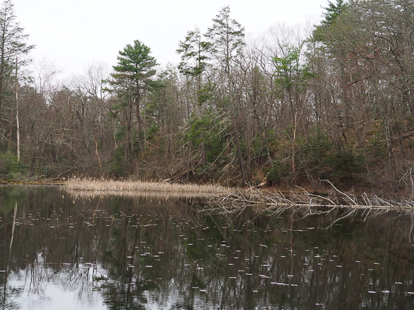
Monday's hike started at Lake Lenape. We would return to this lake for our nature hike on Wednesday, but it would be a very different experience.

As we climbed up the trail, I took advantage of the frequent breaks to take pictures of the views, spring plants, and interesting rocks.
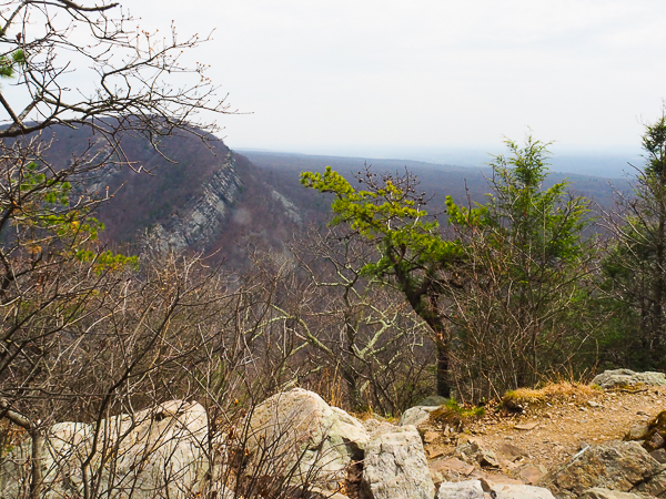
A common complaint about the AT is that there are few expansive vistas. In early spring the foliage isn't out yet, so it is possible to see the surroundings, but in the height of summer, this view would be hidden.
I-80 parallels the Delaware River and it was clear from the constant traffic noise that we were NOT in the wilderness!
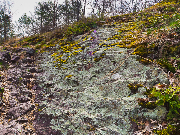
We paused here at the "Council Rock Lookout." I've not found why it has that name.
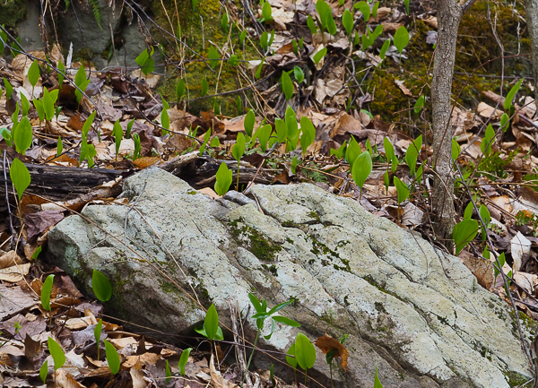
This lichen-covered rock is surrounded by single leaf plants. Canadian mayflower, which is very prevalent along the trails we hiked is often called "false lily-of-the-valley" because the infertile single leaves shown here resemble that plant. Our naturalist told us that the plants only produce a fertile form with two leaves and a flower stalk every six years. We did find a few plants with buds, but none with flowers. Some can be seen at the link above.
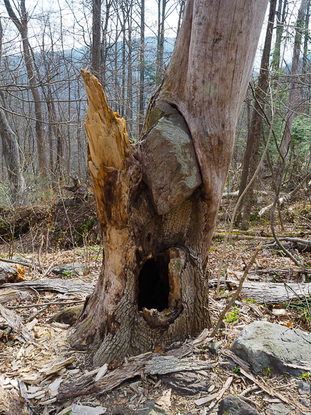
Many times we saw trees growing on rocks. This is one of the few where the tree had picked up a rock as it grew.

At one point we crossed a stream with this small waterfall.
Hiking poles made it easy to teeter across rocks spanning the creeks. In the past I have only used one pole; this was the first time I had gone hiking with two. I'm converted! There were several spots where the additional span of support was useful.
The trip materials included these directions:
Equipment Required:
An 8 liter day pack or larger, good quality
hiking boots, rain gear, sunglasses, insect repellent, a flashlight
and sunscreen. A broad brimmed hat, a camelback or two large refillable
water bottles and trekking poles are strongly recommended. Also you
must have hiking shoes or hiking boots. Walking shoes or sneakers are
not allowed.
Skills Required:
Previous hiking experience. Ability to walk over
often rough, rocky terrain for up to 10 miles. Elevations vary and include
rocky terrain that is similar to walking up or down a waterfall without
the water.
These were excellent recommendations and everyone met them, although many of us did not choose the hikes over five miles.
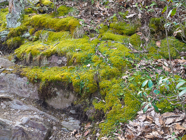 Moss-covered rocks resembled a layer cake. We didn't get as deep into
the geology as the plant and animal life, but the Appalachian Mountains
are very old (over 1.2 billion years) and have unique geology that varies
throughout their range. The rock in this region is largely sandstone.
A (rocky) summary may be found in Wikipedia's discussion of
Appalachian geology.
Moss-covered rocks resembled a layer cake. We didn't get as deep into
the geology as the plant and animal life, but the Appalachian Mountains
are very old (over 1.2 billion years) and have unique geology that varies
throughout their range. The rock in this region is largely sandstone.
A (rocky) summary may be found in Wikipedia's discussion of
Appalachian geology.
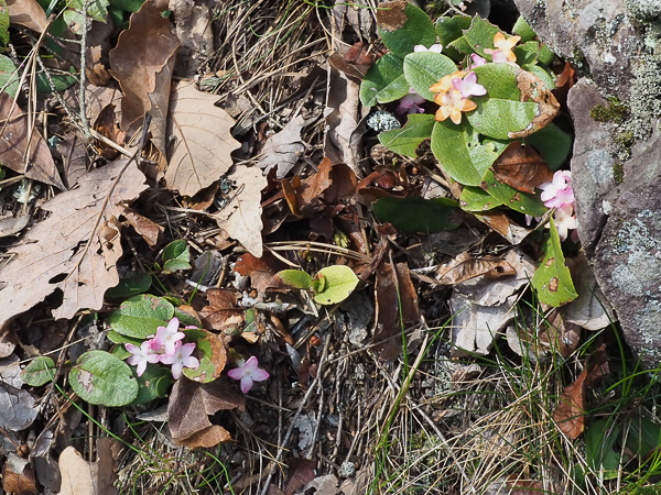
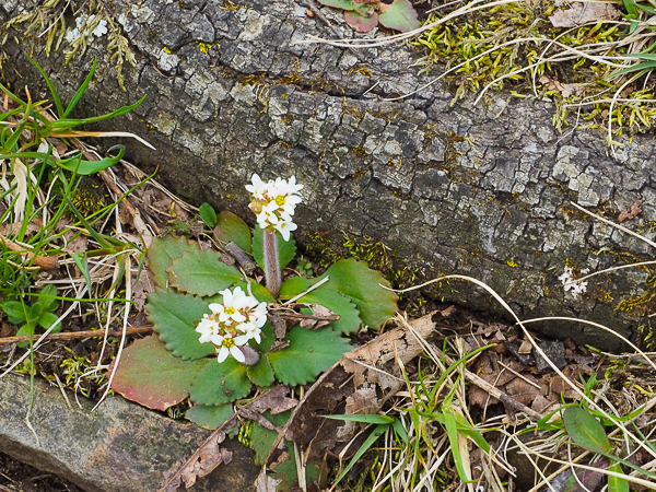
Trailing arbutus comes with pink or white flowers.
It is said to have a lovely scent. I didn't think to sniff it. Besides, I don't easily get down (and up) on my knees any more.
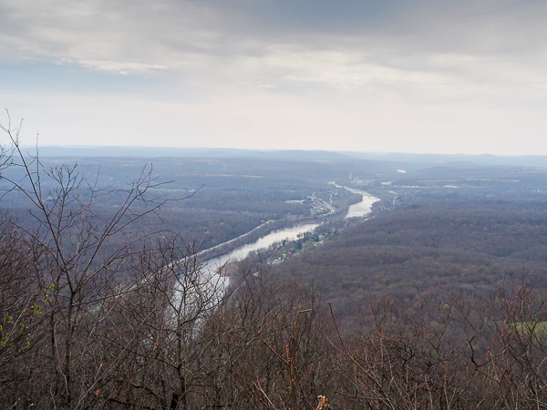
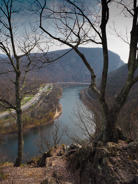 The Delaware Water
Gap. We are considerably higher (huff, puff) than the previous picture.
This is the place where the three hiking groups re-formed. The "Bachelors"
promoted two or three people to the "Masters," and two or three decided
they would have more fun with the "Associates." One of the Associates
joined our Bachelor group bringing our total to three hikers and two
guides.
The Delaware Water
Gap. We are considerably higher (huff, puff) than the previous picture.
This is the place where the three hiking groups re-formed. The "Bachelors"
promoted two or three people to the "Masters," and two or three decided
they would have more fun with the "Associates." One of the Associates
joined our Bachelor group bringing our total to three hikers and two
guides.
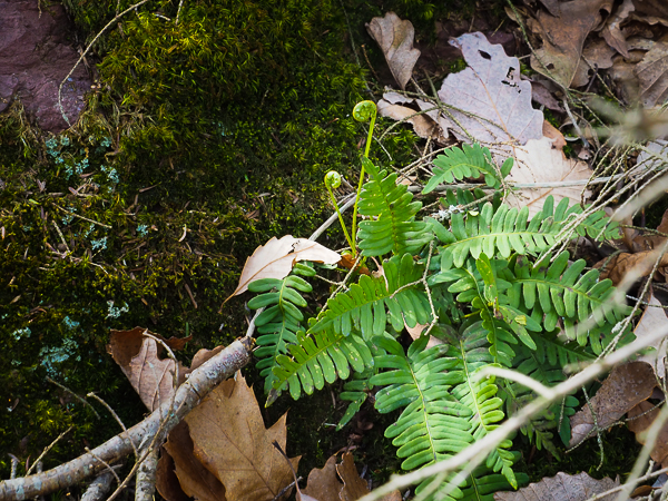
Christmas ferns are just sending up their fiddleheads. Although some fern fiddleheads are edible, those of the Christmas fern are not.
Not long after our group realignment, we reached an area where we had to scramble over a rock face. It is on the other side of this area. It was enough to give one second thoughts!
We then climbed a steep section through arched rhododendrons. It was beautiful, but strenuous enough to give one third thoughts!
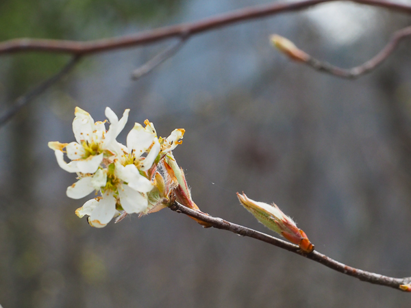
While climbing through the rhododendrons, I saw white petals here and there on the trail. At the rest stop after the climb, I spied the source.
The serviceberry tree grows wild in the eastern US and is also a popular garden tree. The flowers appear before the leaves and the berries that ripen in late spring are favorites for birds and other animals including humans.
Our lunch stop overlooked Mt. Tammany on the New Jersey side of the river. We would hike in that area in a couple of days, but nowhere near the summit. By this time we were pretty hot and sweaty and glad to take a break.
This is our last view of the Delaware River. We've climbed quite a bit higher than our last overlook.
As we were finishing our bag lunch, it began to sprinkle. Fearing that it would get worse, we packed up and got back on the trail, thankful for the cool breeze accompanying the rain. The rain soon stopped, but the breeze continued.
This was about as high as we had to go. From here we walked on a broad trail along the crest of the ridge until we began to descend toward Totts Gap.
I have to thank our naturalist, Rick, from our 3rd day nature walk for identifying many of these plants. I scrolled through my camera display and he nailed every one.
This is Virginia Saxifrage. It was very common throughout our walks.
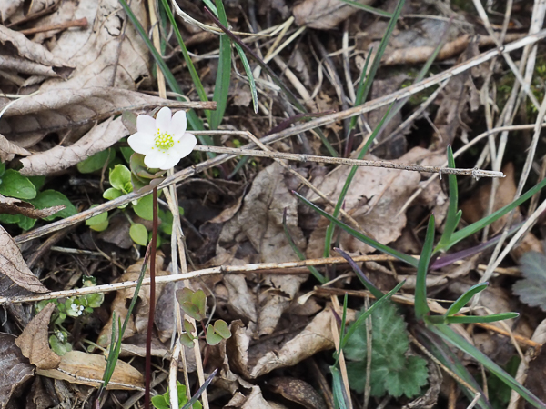
Round-lobed hepatica also comes in blue, pink, and lavender, but I only saw white ones on our walks.
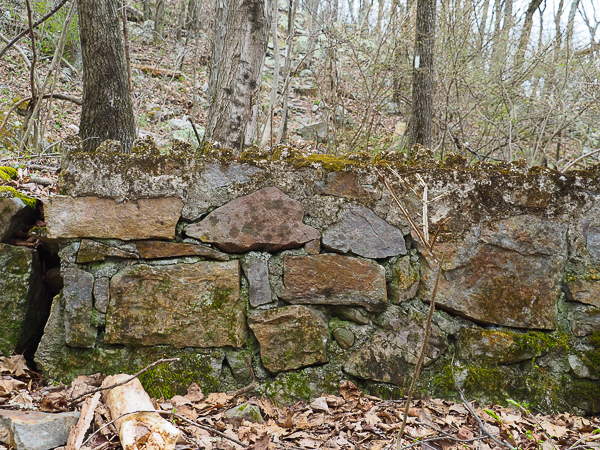
When we reached our destination at Totts Gap, I was puzzled by this foundation of an old building. It was an odd shape and size for a farmstead.
After coming home and doing the research for this travelogue, the mystery deepened. There was at one time a medical research institute led by Dr. Steward Wolf at Totts Gap. The land and buildings were purchased by the county in 2006 and at least some of the buildings were rented by the Totts Gap Art Institute. Their facilities were closed in 2020.
I found a picture of an abandoned building at Totts Gap from 2006. That building was demolished in 2010. It had belonged to the medical institute. I think it unlikely that this is the foundation of that building, but it may have been for another building in the complex. It would be fun to explore the area and see what else might remain.
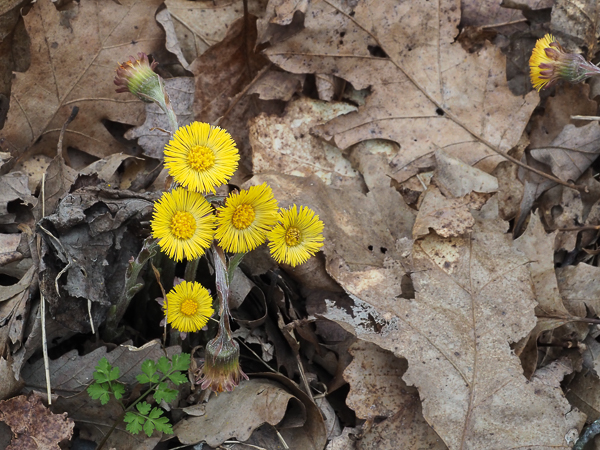
Rick identified this as coltsfoot. It is the only non-native plant I captured. It was imported for medicinal uses (the Latin name means something like "cough no more").
From the Totts Gap intersection with the AT, it was only a short walk back to the parking lot and home. It was a good day, but fatigue (and a heavy-ish pack) caused me to fall towards the end of the hike. I came away only with bruises, but it convinced me to take the easier hikes for the rest of the week. It also convinced me to start shedding backup clothes from my pack, but not my camera!
Click your "back" button to return to the previous page or click for our picture album.